Hunt Smarter.Not Harder.
The whitetail hunter's command center. Every trail-cam photo read for you, your whole property mapped, and tonight's wind window in your pocket — for Canadian hunters and landowners.
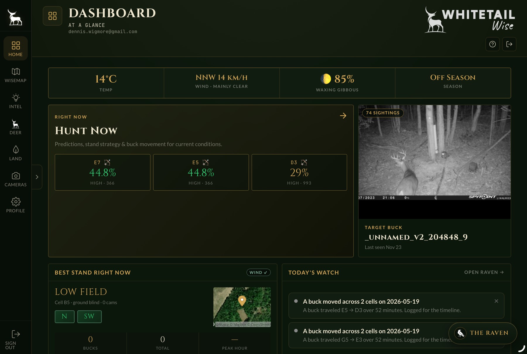
Your whole property, one surface.
Every stand, camera, trail, food plot, water source, and corridor laid onto satellite, topo, and hybrid. A battleship grid for fast radio reference. Live wind painted right on the map. Plan, Hunt, Walk, and Review modes for every season of the year.
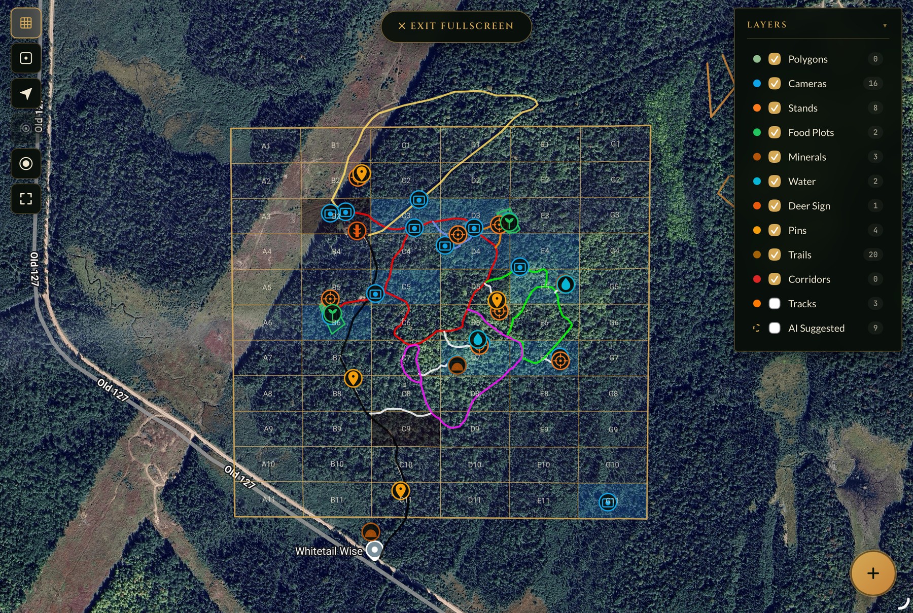
Every photo, read before you do.
Raven Vision strips the empties. The Raven tags buck, doe, fawn, predator, and species — with antler-point counts, age class, and body condition on every buck. Bounding box and confidence drawn right on the frame. You only open the photos that matter.
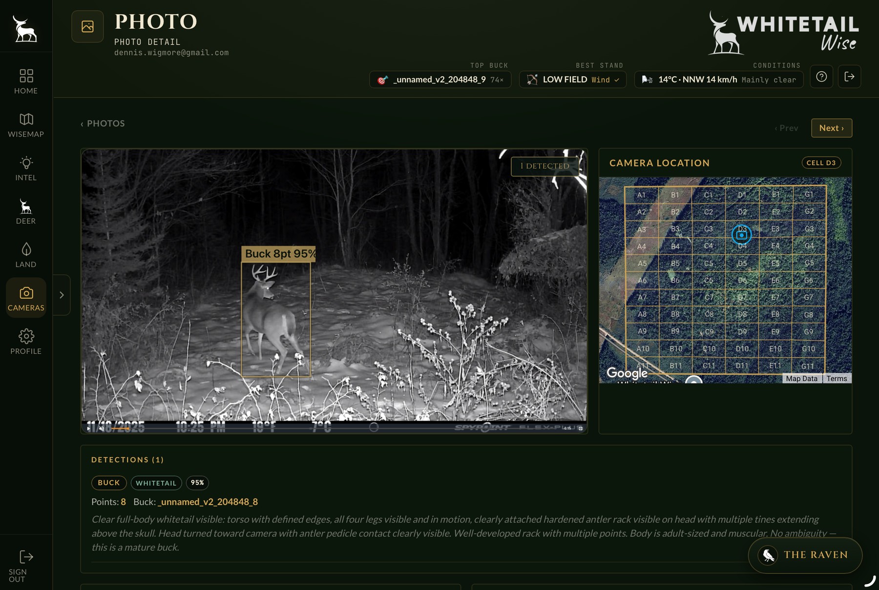
Where to sit tonight, ranked.
The whole grid scored against tonight's wind, weather, moon, and trailing activity. High-confidence cells highlighted, sighting counts inline. Stand Strategy names the stand, the best wind, and the peak hour. The guessing is over — the numbers told you.
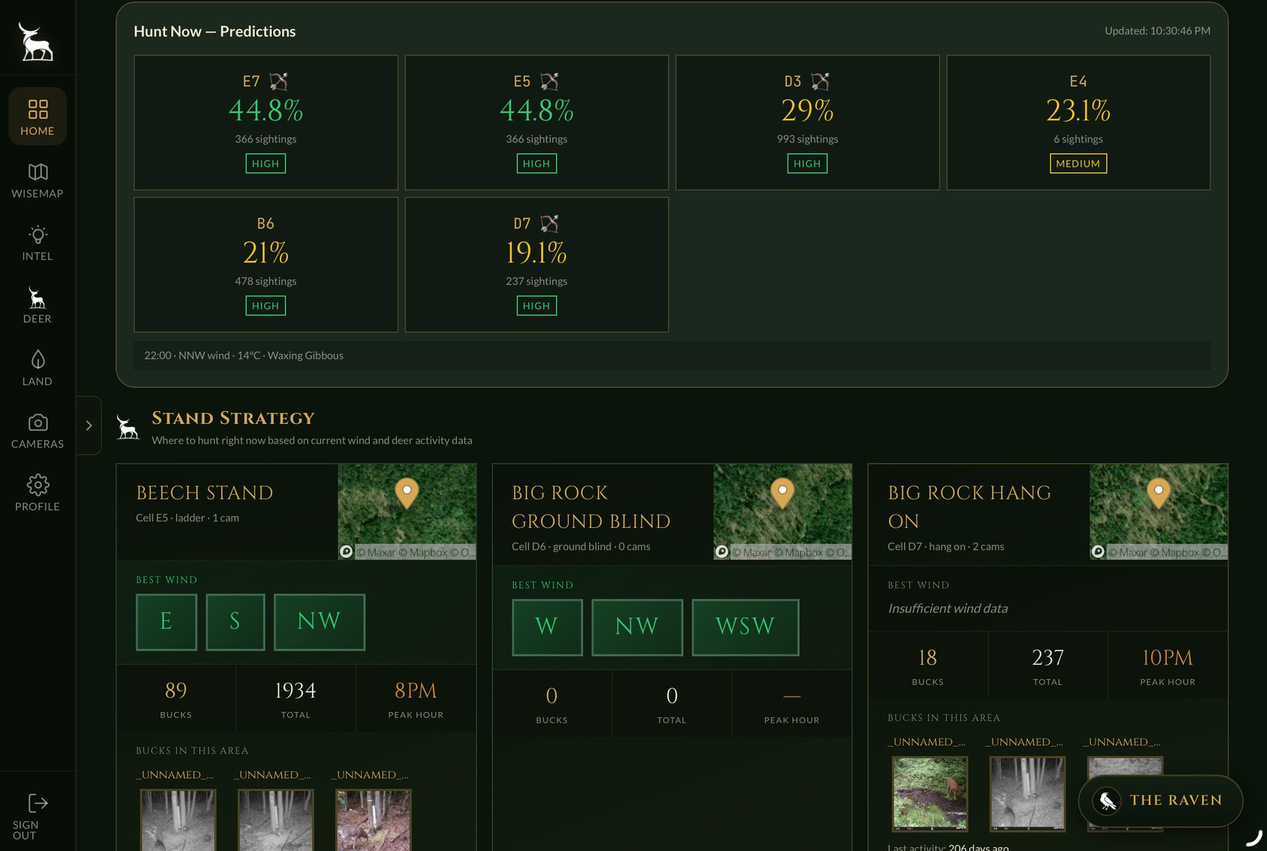
Ask the woods anything.
Your overwatch of the woods. Detections, bucks, stands, wind windows, hunt predictions — The Raven sees it. She has read every camera, every detection, every contour, every pin you have placed, and answers from what she sees. Ask.
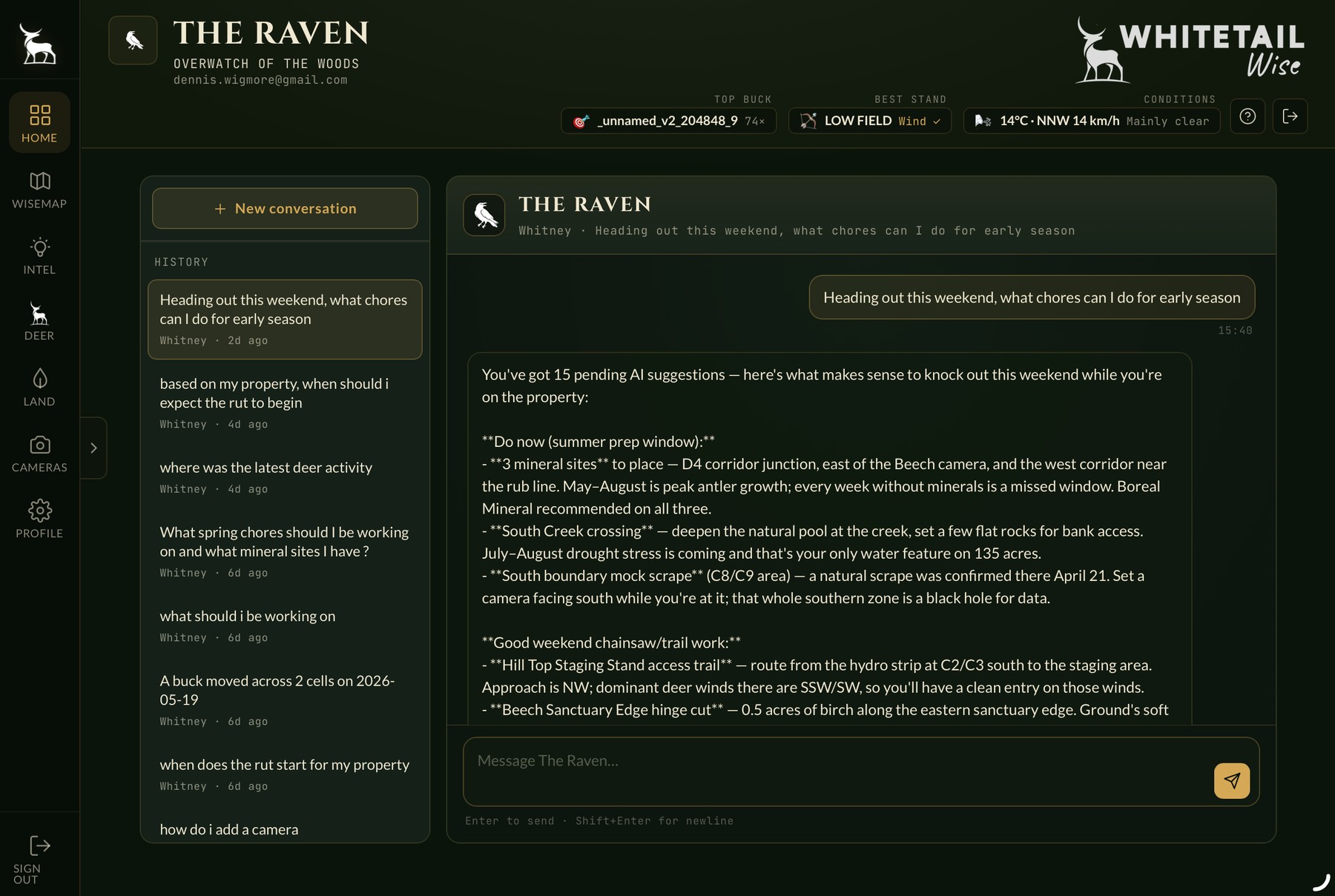
Build a property that hunts better.
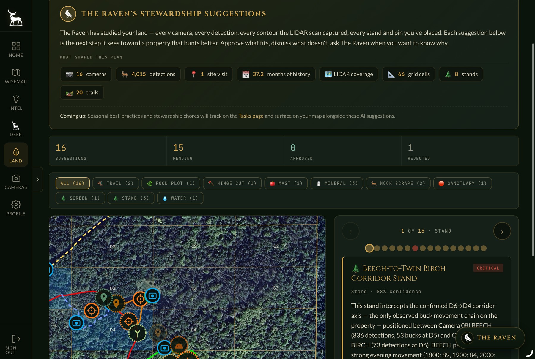
The Raven studies every camera, detection, and contour, then lays out the next moves — trail work, food plots, hinge cuts, mock scrapes, mineral, sanctuary, screening — each with confidence, an exact map location, and the reasoning behind it. Approve what fits. The plan adapts as the season turns.
Everything a serious hunter actually uses.
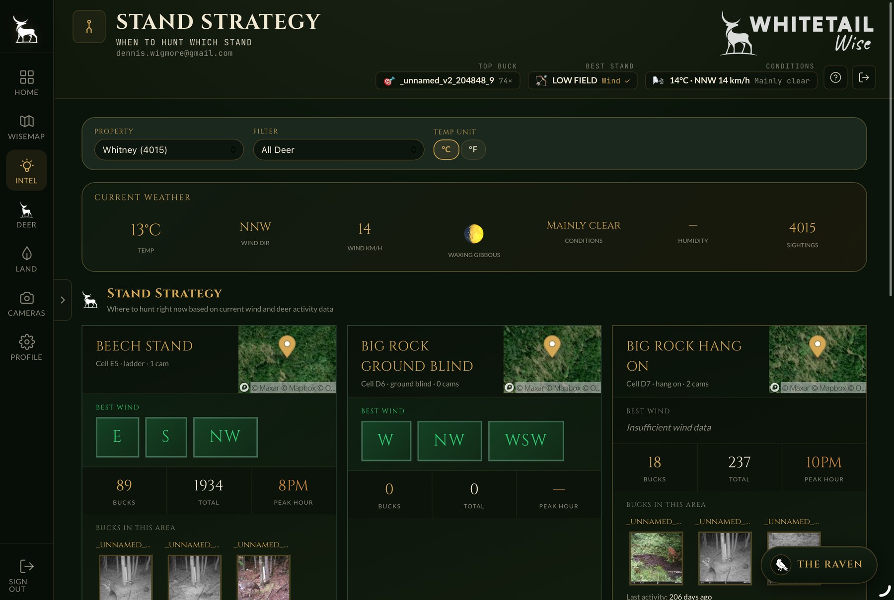
Stand Strategy
Every stand ranked by wind, peak hour, and recent activity.
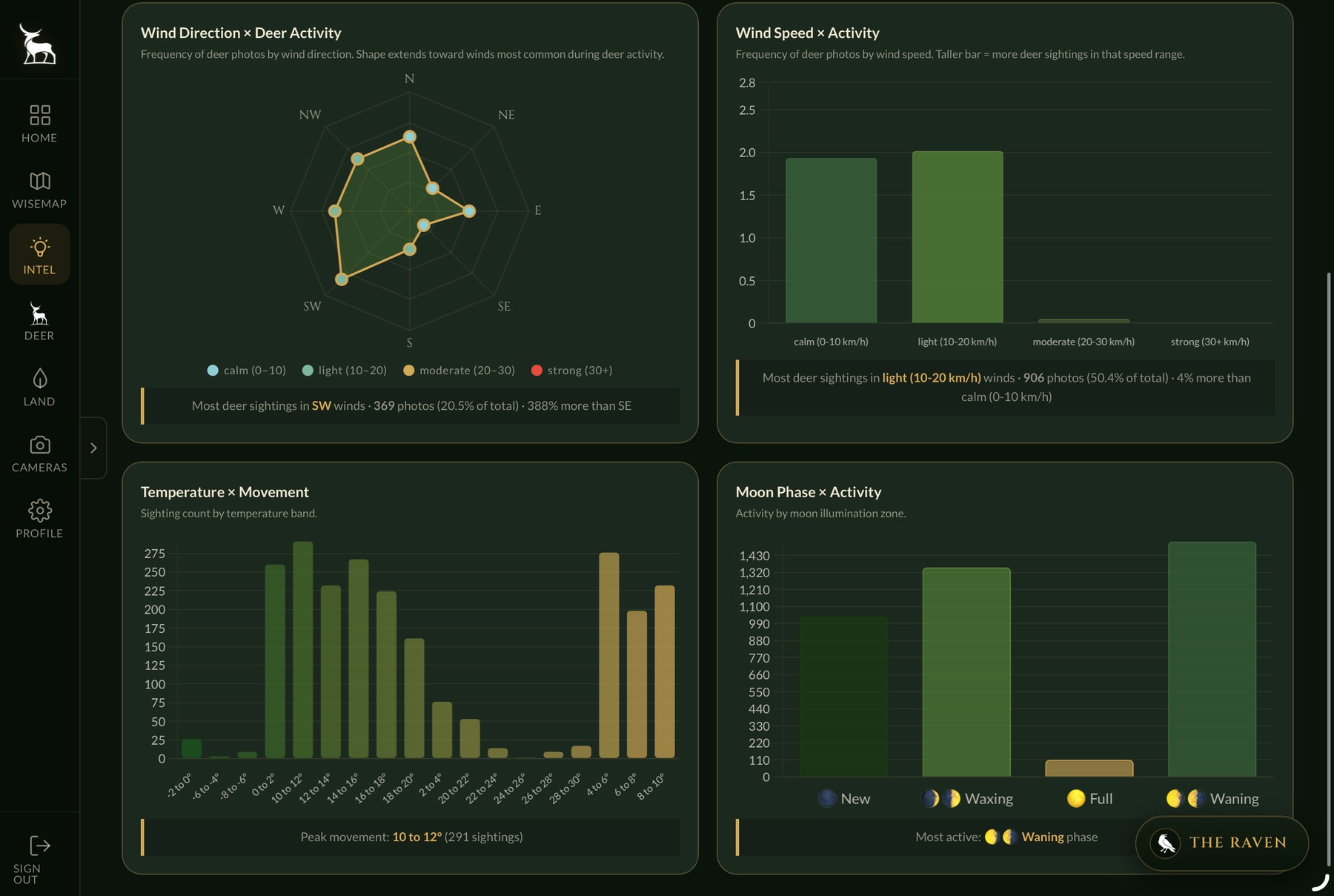
Environment
Wind, moon, temperature, and pressure against deer activity.
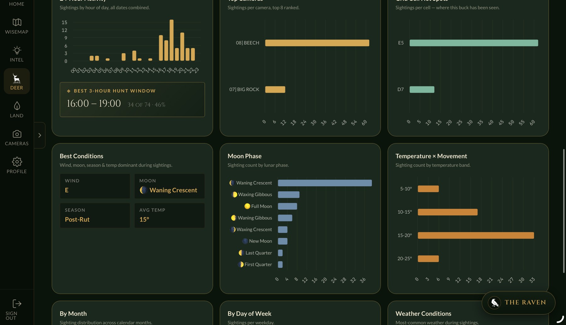
Buck Patterns
24-hour activity, hot cells, and best conditions per buck.
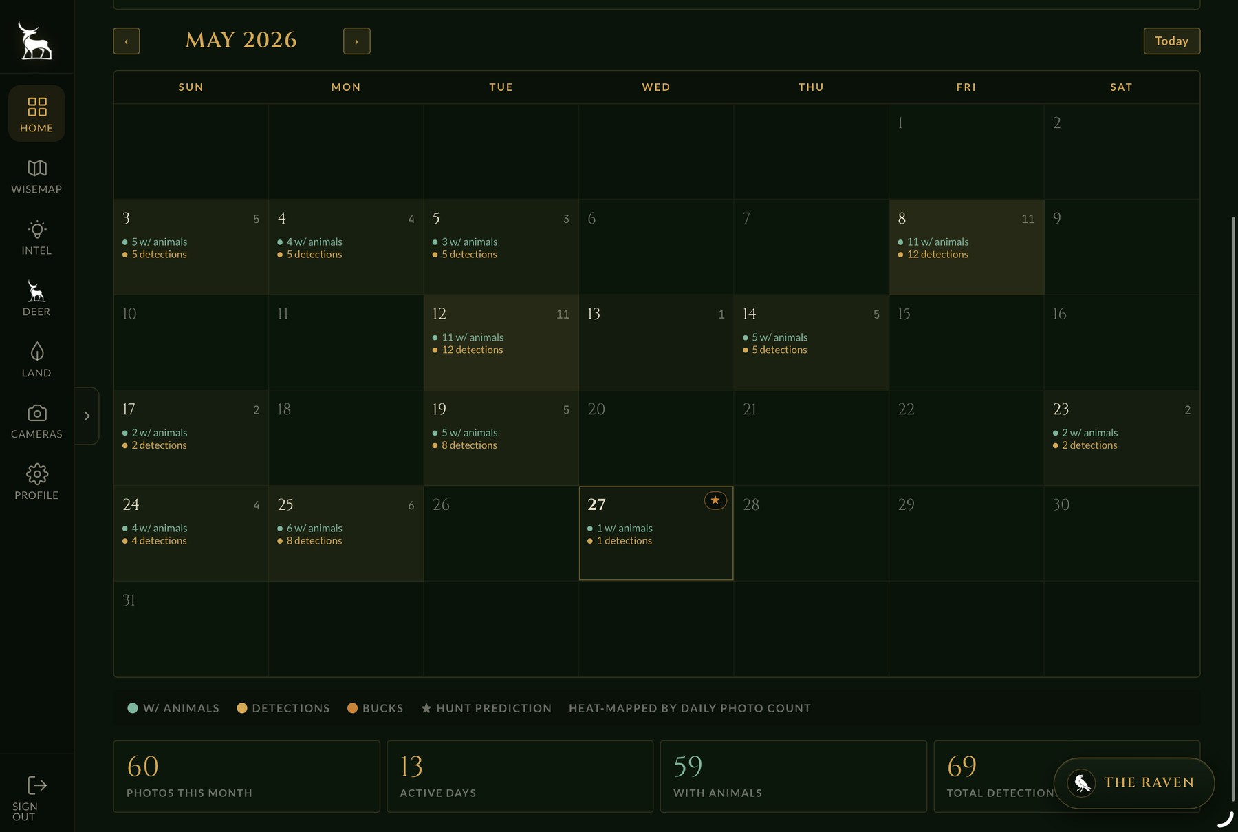
Season Calendar
Twelve months of activity at a glance.
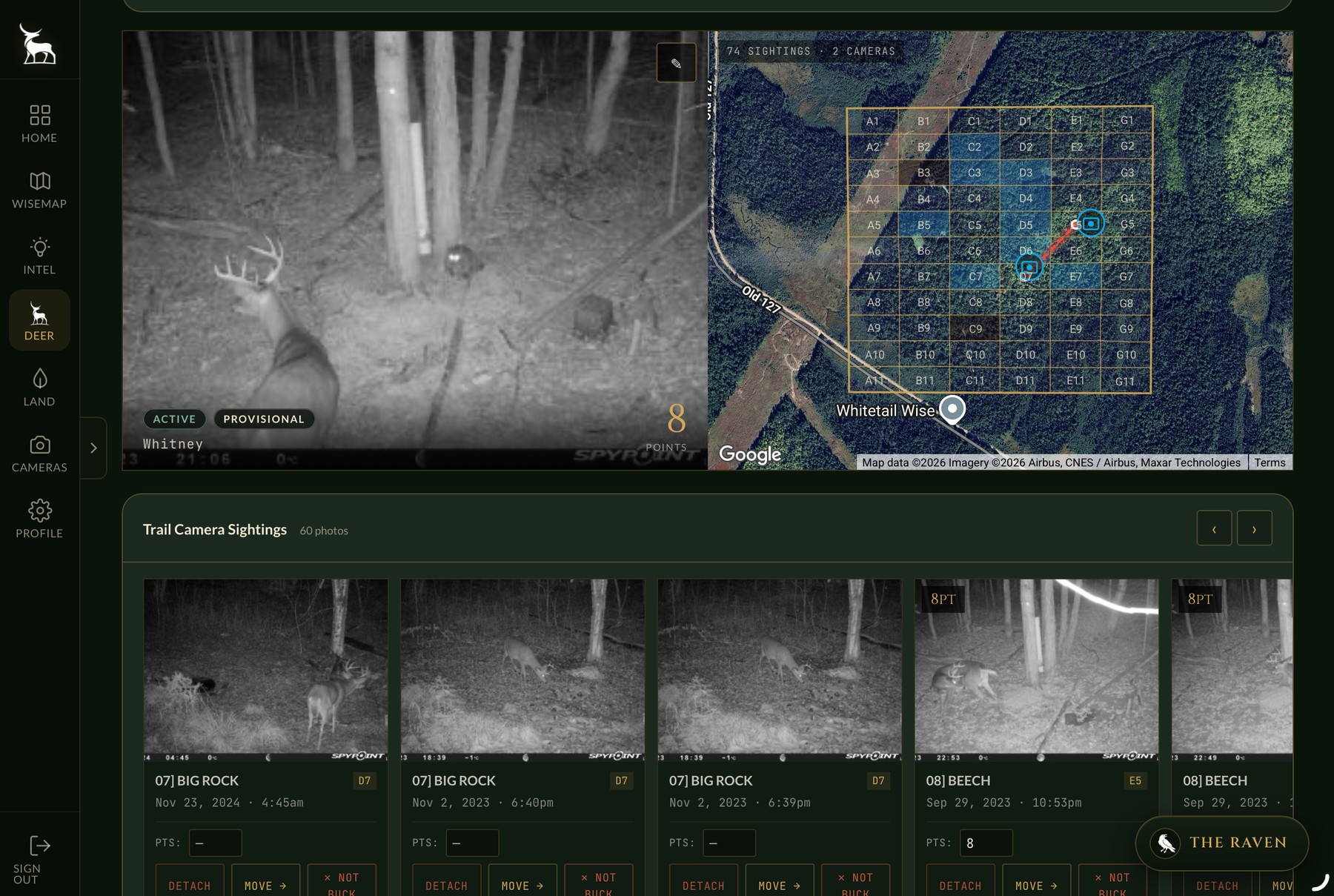
Buck Tracking
Every sighting, across cameras and seasons.
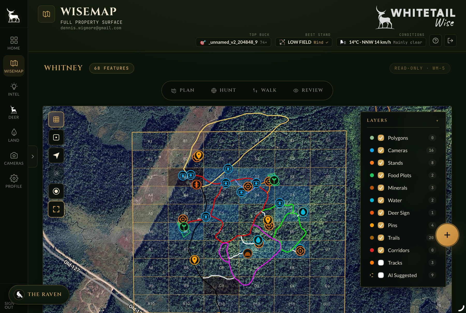
Plan & Walk
Mark your land in the field, plan from the cabin.
Pick the plan for the way you hunt.
- WiseMap with all base layers
- Property grid + offline tiles
- Wind overlay (current + 6h)
- WMU boundaries + regulations
- Hunt Camp — bring your crew on
- Hunt Now: your stands vs tonight's wind
- Free forever — no card, no trial clock
- Everything in Free, plus:
- Unlimited cameras, properties + photo history
- Unlimited Smart Detections (fair use)
- Buck Profiles + auto-clustering + dossiers
- Stand Strategy AI (Tonight's Hunt) + cold-front alerts
- Corridor engine, movement chains, buck smart-match
- Raven unlimited chat + proactive insights
- Hunt log, harvest log, push + SMS alerts
- PDF reports, full data export, read-only API
The things you were about to ask.
Are you listening?
Bring your trail cameras, your property lines, and your questions. Whitetail Wise does the rest. Free to start — no trial clock, no credit card.
Start Free